Sutcliffe Park - geograph.org.uk - 20470.jpg
From WhereToday Expounder
File:Sutcliffe Park - geograph.org.uk - 20470.jpg
No higher resolution available.
Sutcliffe_Park_-_geograph.org.uk_-_20470.jpg (640 × 474 pixels, file size: 142 KB, MIME type: image/jpeg)
Summary
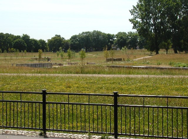
| Description |
English: Sutcliffe Park. The park was massively re-landscaped in 2003/04 to provide the 'River Quaggy Flood Alleviation Scheme'. The heavily channelled river would previously flood Lewisham and nearby areas after exceptionally heavy rain, but Sutcliffe Park now provides a restored 'flood plain' and a natural solution to the problem. |
| Date | |
| Source | From geograph.org.uk |
| Author | David Hatch |
| Attribution (required by the licence) | David Hatch / Sutcliffe Park / |
| Object location | | View this and other nearby images on: OpenStreetMap |
|---|
_&language=en-gb)
Licensing

|
This image was taken from the Geograph GB & Eire project collection. See this photograph's page on the Geograph website for the photographer's contact details. The copyright on this image is owned by David Hatch, and is licensed for reuse under the Creative Commons Attribution Share-Alike 2.0 license.
|
This file is licensed under the Creative Commons Attribution-Share Alike 2.0 Generic licence.
Attribution: David Hatch
- You are free:
- to share – to copy, distribute and transmit the work
- to remix – to adapt the work
- Under the following conditions:
- attribution – You must give appropriate credit, provide a link to the licence, and indicate if changes were made. You may do so in any reasonable manner, but not in any way that suggests the licensor endorses you or your use.
- share alike – If you remix, transform, or build upon the material, you must distribute your contributions under the same or compatible licence as the original.
File history
Click on a date/time to view the file as it appeared at that time.
| Date/Time | Thumbnail | Dimensions | User | Comment | |
|---|---|---|---|---|---|
| current | 05:16, 30 January 2010 | | 640 × 474 (142 KB) | wikimediacommons>GeographBot | == {{int:filedesc}} == {{Information |description={{en|1=Sutcliffe Park. The park was massively re-landscaped in 2003/04 to provide the 'River Quaggy Flood Alleviation Scheme'. The heavily channelled river would previously flood Lewisham and nearby areas |
File usage
The following page uses this file: