Parkland at Turvey House, Turvey - geograph.org.uk - 284958.jpg
From WhereToday Expounder
File:Parkland at Turvey House, Turvey - geograph.org.uk - 284958.jpg
No higher resolution available.
Parkland_at_Turvey_House,_Turvey_-_geograph.org.uk_-_284958.jpg (640 × 480 pixels, file size: 168 KB, MIME type: image/jpeg)
Summary
| Description |
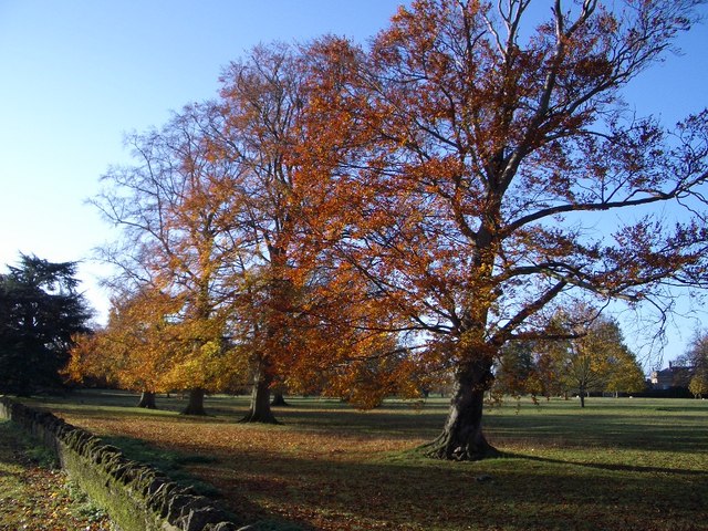
English: Parkland at Turvey House, Turvey The Parkland forms part of the grounds of Turvey House that sits between the River Great Ouse and the Turvey-Carlton Road from where this picture was taken. |
| Date | |
| Source | From geograph.org.uk |
| Author | Nigel Stickells |
| Attribution (required by the licence) | Nigel Stickells / Parkland at Turvey House, Turvey / |
| Camera location | | View this and other nearby images on: OpenStreetMap |
|---|
_heading:225.00&language=en-gb)
| Object location | | View this and other nearby images on: OpenStreetMap |
|---|
_heading:225.00&language=en-gb)
Licensing

|
This image was taken from the Geograph GB & Eire project collection. See this photograph's page on the Geograph website for the photographer's contact details. The copyright on this image is owned by Nigel Stickells, and is licensed for reuse under the Creative Commons Attribution Share-Alike 2.0 license.
|
This file is licensed under the Creative Commons Attribution-Share Alike 2.0 Generic licence.
Attribution: Nigel Stickells
- You are free:
- to share – to copy, distribute and transmit the work
- to remix – to adapt the work
- Under the following conditions:
- attribution – You must give appropriate credit, provide a link to the licence, and indicate if changes were made. You may do so in any reasonable manner, but not in any way that suggests the licensor endorses you or your use.
- share alike – If you remix, transform, or build upon the material, you must distribute your contributions under the same or compatible licence as the original.
File history
Click on a date/time to view the file as it appeared at that time.
| Date/Time | Thumbnail | Dimensions | User | Comment | |
|---|---|---|---|---|---|
| current | 19:47, 14 December 2010 | | 640 × 480 (168 KB) | wikimediacommons>GeographBot | == {{int:filedesc}} == {{Information |description={{en|1=Parkland at Turvey House, Turvey The Parkland forms part of the grounds of Turvey House that sits between the River Great Ouse and the Turvey-Carlton Road from where this picture was taken.}} |date= |
File usage
There are no pages that use this file.