Dunseverick Castle - geograph.org.uk - 475756.jpg
From WhereToday Expounder
File:Dunseverick Castle - geograph.org.uk - 475756.jpg
No higher resolution available.
Dunseverick_Castle_-_geograph.org.uk_-_475756.jpg (640 × 402 pixels, file size: 215 KB, MIME type: image/jpeg)
Summary
| Description |
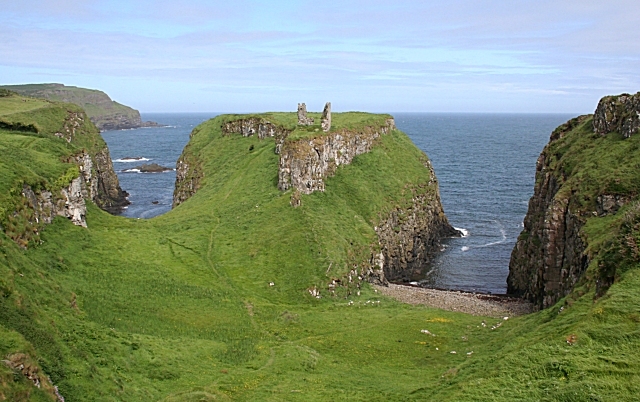
English: Dunseverick Castle The castle was one of the great duns of Ireland, and takes its name from Sobhairce, whose fort it was, and may have been the place from which the ancient kingdom of Dalriada was ruled. The ruins date from the 16th century. The headland on which it stands is bounded by two inlets, each marking the line of a geological fault. |
| Date | |
| Source | From geograph.org.uk |
| Author | Anne Burgess |
| Attribution (required by the licence) | Anne Burgess / Dunseverick Castle / |
| Camera location | | View this and other nearby images on: OpenStreetMap |
|---|
_heading:337.00&language=en-gb)
| Object location | | View this and other nearby images on: OpenStreetMap |
|---|
_heading:337.00&language=en-gb)
Licensing

|
This image was taken from the Geograph GB & Eire project collection. See this photograph's page on the Geograph website for the photographer's contact details. The copyright on this image is owned by Anne Burgess, and is licensed for reuse under the Creative Commons Attribution Share-Alike 2.0 license.
|
This file is licensed under the Creative Commons Attribution-Share Alike 2.0 Generic licence.
Attribution: Anne Burgess
- You are free:
- to share – to copy, distribute and transmit the work
- to remix – to adapt the work
- Under the following conditions:
- attribution – You must give appropriate credit, provide a link to the licence, and indicate if changes were made. You may do so in any reasonable manner, but not in any way that suggests the licensor endorses you or your use.
- share alike – If you remix, transform, or build upon the material, you must distribute your contributions under the same or compatible licence as the original.
File history
Click on a date/time to view the file as it appeared at that time.
| Date/Time | Thumbnail | Dimensions | User | Comment | |
|---|---|---|---|---|---|
| current | 22:03, 4 February 2011 | | 640 × 402 (215 KB) | wikimediacommons>GeographBot | == {{int:filedesc}} == {{Information |description={{en|1=Dunseverick Castle The castle was one of the great duns of Ireland, and takes its name from Sobhairce, whose fort it was, and may have been the place from which the ancient kingdom of Dalriada was r |
File usage
There are no pages that use this file.